The
developments in the EUR Region, as described previously, made it
necessary to convene in 1966 a further, the fifth, Regional Air
Navigation Meeting in order to try and bring the Regional Plan as a
whole up to date and include therein the foreseeable future
requirements. The large attendance (and the first participation by
observers from States of the Central and Eastern parts of the EUR
Region) together with the growing complexity of the planning machinery
showed again, as already in 1958, that the method of achieving this in
one single four -weeks meeting was hardly adequate, despite the efforts
of all participants involved.
Primary reasons for this were:
1.
traffic predictions were becoming more and more difficult
since peak traffic periods, to which the air navigation system was to
respond were largely caused by charter operations during the summer
holiday season and a representative organisation of charter operators
comparable to that of the scheduled airlines (IATA) did not exist;
2. the technical equipment required to allow ground services to increase
its traffic handling capacity was becoming not only more complex, thus
requiring longer "lead-times" for its installation but ' because of the
rapid technical progress, especially in the field of electronics, was
also subject to frequent modifications to reflect latest technology with
the inevitable changes in cost, and
3. because of the increased use of automation in such
equipment, the question of compatibility of such equipment in adjacent
facilities, provided by different States, gained more and more
importance.
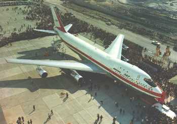
Boeing's 747 launched the wide-body age
Despite these additional difficulties, the 1966 Meeting
succeeded in preparing a new Regional Plan, however with the proviso
that its parts dealing with the air traffic and the communication
services would require close observation in order to make necessary
adjustments when this was required by circumstances. That this was a
justified precaution, was born out by the fact that, already in 1968 it
was necessary to hold a special meeting in order to make a complete
review of the plan for VHF air-ground communications in the Region and,
one year later, a further special meeting dealing again with
communications and air traffic services (mainly radio navigation aids,
use of secondary surveillance radar (SSR) and ground-ground
communications between ATS units).
It is obvious that the preparation, conduct
and follow-up of these meetings presented a formidable challenge to the
Paris Office, not only from the point of view of sheer workload but also
from that of consolidation-- of national requirements because the air
traffic services and communications part of the Regional Plan assumed
more and more the character of integrated regional systems rather than
the accumulation of a number of independent national systems with more
or less loose connections. It should also be mentioned that, as regards
this consolidation task, the first beneficial effects of Eurocontrol's
work became apparent, even though this new organization still had its
own particular difficulties to cope with.
In any case, by about 1970, it was evident
that, if the air navigation system in the EUR Region was to keep pace
with the growing demands imposed on it, it was necessary to provide for a
continuous international planning machinery which conducted planning on
a regional scale, based on reliable information regarding expected
demands on such a system.
Operational and technical aspects, supporting this contention were:
1.
the growing amount of delays which were experienced by
operators in Europe, especially during the critical week-end periods of
the summer season because the air traffic control system was, at
certain, internationally critical points overloaded and has therefore to
resort to restrictions in the acceptance of air traffic. One
side-effect of this situation, illustrating the interdependence of the
ATS system on a scale occasionally even extending beyond the EUR Region,
was that these artificially imposed limitations on the flow of air
traffic affected areas where the locally generated air traffic itself
could have been handled without difficulties. (To illustrate this in an
extreme example, it occurred that flights from East Africa to major
airports in Europe had to wait up to 2 or 3 hours on the ground in
Nairobi before they could be accepted in the European traffic flow some 4
or 5 hours later);
2. the
lack of reasonably reliable forecasts regarding traffic developments,
either in a general manner or in detail, related to specific routes,
days and/ or times of the day; and
3. the complete lack of an agreed method or methods permitting to
assess, within reasonable tolerances, the likely traffic handling
capacity of an ATC unit under specified circumstances so as to serve as
an important planning factor.
This, together with a lack of agreed methods for the
formulation, promulgation, distribution and cancellation of traffic
restrictions imposed by ATC units which had reached the limit of their
traffic handling capacity and the inadequacies of the existing
ground-ground communications between adjacent area control centres
(ACCs) in the critical areas of the Region resulted in rather
unsatisfactory conditions to the operators accompanied by significant
financial penalties.
In the field of civil-military co-ordination, the
problems created by the simultaneous presence of civil and military
operations in the upper airspace still persisted and the required
co-operation between civil and military ground services was only slowly
gaining ground. In fact, in many instances progress was directly
proportional to the establishment of mutual confidence between these two
users of the airspace.
In addition, due to the technical advances made in the
field of radar on both sides in Europe, the military adopted new flying
techniques, the so-called low-level operations, i.e. high speed flights
at or below 500m (1600 feet) above the ground. This created an entirely
new range of problems between civil "general aviation" flights, i.e.
visual flights by light aircraft including gliders and helicopters, and
the fast military operations. It was therefore believed that it would be
essential to find common ways and means to obtain a form of "co-habitat
1 on" which ensured the essential degree of safety for both parties
involved.
Much of the preparatory work to develop arrangements for
the resolution of the problems mentioned above was done in Eurocontrol
and with active participation by the Paris Office. In order to make
these arrangements applicable in the EUR Region, the available material
had to be processed through the Paris Office in order to ensure
participation and consultation of all interested States in the EUR
Region (i.e. Provider States located in the region, as well as user
States having an interest in it).
NAT Region
Because
of the stalemate regarding lateral separation in the NAT Region, work
on the improvement of the air navigation system in the North Atlantic
Region and its traffic handling capacity was given very high priority by
the NAT Systems Planning Group (NAT SPG) in order to obtain a consensus
on the conditions under which a reduction of the lateral separation
could be accepted by all parties concerned.
To this extent, the NAT SPG, with the assistance from NAT
provider States organised one of the largest traffic data collections
which had ever been undertaken in order to obtain detailed information
on the actual navigational performance of aircraft while operating in
the North Atlantic. This meant not only the recording, by radar, of
aircraft positions on either side of the Atlantic and their comparison
with ATC flight data but the USA also stationed, for a considerable
time, radar-equipped ships in mid-Atlantic under the major air routes to
gain navigation information on aircraft at positions which were
normally outside any surveillance possibility. To collate and evaluate
the information so obtained, extensive use was made of computers which
were initially made available by Canada and the United Kingdom and which
are now also
In the meantime, the NAT SPG started to develop a
mathematical-statistical model to which the data obtained in the
collection exercise could be applied in order to determine which
separation minimum could be considered to be safe when related to a
specific average navigation performance, in other words, which average
navigation performance was required to permit the safe application of a
specific separation minimum.
As this was an entirely new field in air navigation, it was
inevitable that the development of the appropriate methodology and its
use in practical application gave rise to considerable discussions
before a consensus could be achieved between all parties concerned
within the NAT SPG. In any case, by around 1970, it had been found that
the best Method to increase the traffic handling capacity in the North
Atlantic was to apply a form of composite separation, i.e. to form a
basic track system in which parallel tracks were separated laterally by
120 NM and vertically by 600m (2000 feet) and to insert into this system
further parallel tracks which were separated by 60NM from any two of
the basic tracks but also by 300m (1000feet) from the levels used on
these basic tracks :
After a trial period of this new procedure, the Fifth NAT
Regional Meeting in 1970 accepted it for routine application and
requested the NAT SPG to continue its work towards further reduction in
separation in the North Atlantic commensurate with the necessary
improvements of the average navigation performance achieved in routine
flights by operators. Steps indicated in this direction were:
1. a general reduction of lateral separation to 60 NM, and
2. a progressive reduction of longitudinal separation.
